Travel Guide
Kamikochi 3-Day Hiking Itinerary: Japan's Alpine Valley Done Right
Want the editable version of this route?
Open the Instaboard template and adapt stops, timing, and notes to fit your trip.
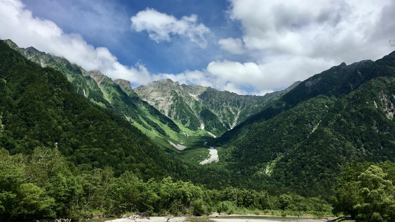
Kamikochi is, honestly, a high-altitude valley in the Japanese Alps where the river runs absurdly turquoise, the peaks hit three thousand meters, and cars aren't allowed. Bad timing will cost you here. Show up at the wrong hour and you'll photograph the famous bridge behind a wall of tour groups.
Summer is when Kamikochi opens up. Mild alpine temperatures, wildflower meadows in bloom, every trail walkable from mid-June through October.
Day 1
Day one starts at a castle built to survive wars and ends at a bridge named after mythical river creatures. This is the day the valley opens up.
Matsumoto Castle
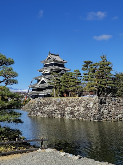
Matsumoto Castle is one of only twelve original castles left in Japan. Not a concrete replica, not a rebuild, the actual four-hundred-year-old structure. The black-lacquer exterior earned it the nickname Crow Castle, and that black cladding was fireproofing, not decoration. It was built to survive, and it did.
Inside, the wooden staircases are so steep you'll climb in single file, gripping a handrail, developing a whole new respect for anyone who fought a war in armor. Morning is when the moat reflections are sharpest and the crowds are thin. Bring cash for entry, because there's no card machine at the gate.
Tip: Arrive early to beat the weekend crowd and bring cash for the entry fee.
Kappa-bashii Bridge
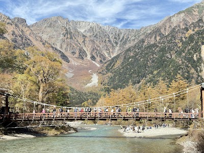
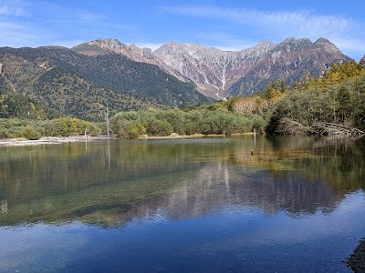
After the bus into the mountains, Kappabashi Bridge is where Kamikochi introduces itself. Wooden suspension bridge, turquoise glacial river, the Hotaka range filling the sky behind it. The bridge sways underfoot, the water below is cold enough to numb your hand in seconds, and the mountain air smells like nothing, just clean.
The bridge is named after kappa, the mythical water creatures said to live in these rivers. The statues nearby are goofier than the mythology suggests, but the river color is no exaggeration. Cross to the far side and turn around. The reverse angle is the shot most people miss because they're too busy photographing from the near side.
Tip: After the 90-minute bus transfer, cross Kappabashi Bridge over the turquoise Azusa River with the Hotaka range as a backdrop.
Kamikochi Visitor Center, Chubu Sangaku National Park
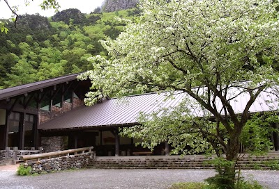
Cell signal in this valley is unreliable, and the Visitor Center near the bus terminal is where you get real trail conditions, paper maps, and context for what's ahead. Grab a paper trail map here because your phone will not save you in Kamikochi, and the exhibits on how these mountains formed are genuinely worth five minutes.
Ask about bear sightings and trail closures. This is one of the few places with that information updated daily, and the difference between knowing and guessing matters at altitude. Most visitors skip the exhibits and walk straight past, which is how you end up being the only person at the next viewpoint who actually knows what they're looking at.
Tip: Check trail conditions and opening hours at the Visitor Center near the bus terminal. Pick up a paper trail map because cell signal is unreliable.
Day 2
Day two goes deeper. Volcanic ponds with standing dead trees, a waterfall that looks exactly like its name, and a sacred pond at the far end of the valley.
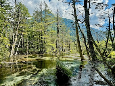
Taisho Ike Pond
Taisho Ike looks like a set piece, dead trees standing in impossibly clear water against a mountain backdrop, but a volcano created this by flooding a forest in 1915. Those standing trunks are the ghosts of trees alive in 1914, and Mt. Yakedake, the volcano that killed them, is still active with steam vents visible from the trail.
Get here by eight in the morning because the water goes mirror-still before the wind picks up, and tour groups start arriving around nine-thirty. A volcano accidentally made one of Japan's most photographed scenes. The dead trees have been posing for a hundred years and show no signs of stopping.
Tip: Arrive by 8 AM to catch mirror reflections at Taisho Ike before the crowd arrives and the wind picks up.
Shirahige Waterfall
Further along the trail, Shirahige means 'white beard,' and once you see thin white streams fanning down mossy green rock, the name makes complete sense. Cool mist hits you before the falls come into view, and the sound swallows footsteps. The trail goes quiet in a way it doesn't anywhere else.
This has been a natural rest stop for walkers heading deeper into the valley for over a century, and nothing about that role has changed. Stand back from the spray because it reaches further than you'd think and will fog your camera lens before you've even framed the shot.
Tip: Walk the riverside trail to Shirahige Waterfall where white streams cascade down mossy rock. Wear a warm layer because the spray cools the air.
Myōjin First Pond
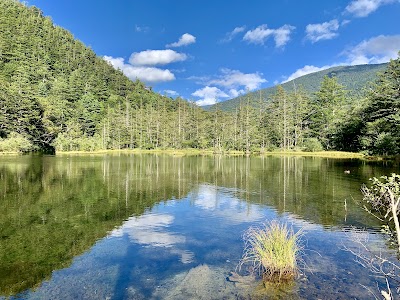
Myōjin First Pond sits in old-growth forest at the far end of the valley trail, beside Hotaka Shrine. It's the quietest major spot in Kamikochi. The water reflects the surrounding trees with near-perfect clarity, and there's an optional boat ride on the pond that almost nobody knows about.
Afternoon works because most day-trippers have turned back by then, so the crowd thins out just when you want it to. Budget time for the walk back (same trail out) and check conditions before committing, because summer afternoon storms roll in fast here.
Tip: Hike to the sacred Myojin First Pond surrounded by primeval forest. Book the optional boat ride in advance during peak summer weekends.
Day 3
Day three is the easier one. Flat valley walking, a wildflower side trail most people skip, and a hot spring to finish it all off.
Mt. Yake Trail Head
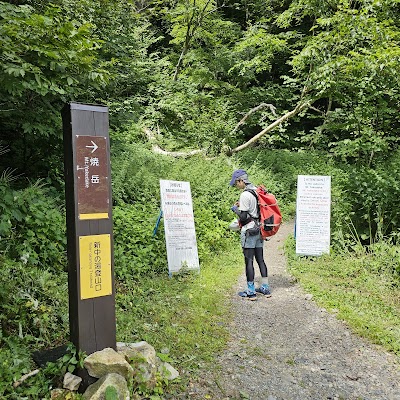
You don't need to climb anything here. The main valley trail is flat, shaded by birch and larch, with three-thousand-meter peaks on both sides. You're walking at, what, fifteen hundred meters elevation with alpine-expedition scenery, barely breaking a sweat. The mountains do all the work and you're just the audience.
Mt. Yake, the active volcano at the head of the valley, is the same one that created Taisho Pond. You can see steam rising from it on clear mornings. Start early because the morning light on the peaks is dramatic and the traffic thinner, and carry water since refill points are scarce past the terminal area.
Tip: Walk the main riverside trail lined with birch and larch. Catch the sunrise for dramatic light on the peaks; early buses make this easy.
Dakesawa Marsh
A short side trail leads to Dakesawa Marsh, where summer wildflower meadows bloom in colors the rest of Kamikochi, all grey rock and green forest, doesn't have. This marsh is what the valley looked like before the trees moved in: flat glacial ground, cooler and damper the moment you step off the main trail.
Even on busy days this detour has a fraction of the foot traffic because most walkers don't bother with the turnoff. The main trail has thousands of people photographing the same mountain. This side trail has wildflowers and approximately nobody.
Tip: Take the side trail to Dakesawa Marsh for summer wildflower meadows away from the crowds. Pack a warm layer because marshland stays cool.
Hirayu-no-Yu
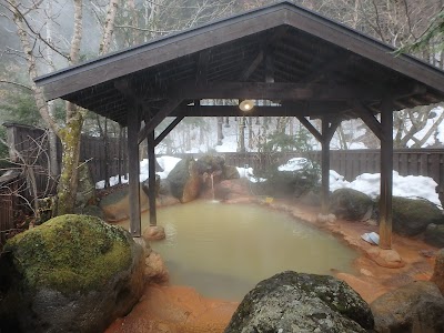
Hirayu Onsen is one of the oldest hot spring towns in the region, and it's also where the buses depart. The soak and the ride home start from the same place. After three days of walking through thin alpine air, you're sitting in hot mineral water with steam rising around you and cool mountain air on your face.
These springs were soaking travelers centuries before anyone built a road to Kamikochi. The Japanese figured out the correct way to end a hike a very long time ago. If it's your first onsen: no swimsuits, shower before entering, tie up long hair. Reserve a private outdoor bath ahead of time on summer weekends.
Tip: Transfer to Hirayu Onsen for a soak in one of Japan's oldest hot spring towns. Reserve a private open-air bath in advance during summer.
What to book ahead
- Book Kamikochi bus tickets (2-4 weeks ahead) - Summer buses from Matsumoto or Takayama sell out; reserve round-trip seats online.
- Reserve accommodation in Kamikochi or Hirayu (1-2 months ahead) - Mountain lodges and the Imperial Hotel fill quickly in July-August.
- Reserve private onsen bath at Hirayu-no-Yu (1 week ahead) - Private open-air baths are limited and high-demand in summer.
- Check trail conditions and bear alerts (Day before each hike) - Monitor the Visitor Center website for closures and weather warnings.
What to pack
Essentials
- Hiking shoes with good grip - Trails can be muddy and slippery after rain
- Rain jacket - Afternoon thunderstorms are common in the Japan Alps during summer
- Sunscreen and hat - UV exposure increases at altitude with limited shade
- Reusable water bottle - Tap water in Kamikochi is drinkable; few shops along trails
- Daypack (20-30L) - Carry layers, snacks, and rain gear for full-day hikes
Nice to have
- Trekking poles - Helpful for longer days if you have knee sensitivity
- Binoculars - Great for spotting macaques and alpine birds along the river
- Insect repellent - Mosquitoes active near marshland in July and August
- Swimsuit - Needed for onsen baths at Hirayu
Final take
Kamikochi is the rare place where the valley floor walk is the main event. You don't need to summit anything to feel like you've been somewhere that recalibrates what scenic means.
Plan this trip
Turn this guide into an editable trip plan
Open the route in Instaboard, adjust the stops, and share the itinerary with your travel group.